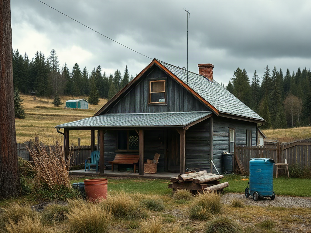
Washington’s Rainfall Patterns and Water Reality
Washington does not have a single rain pattern. Marine weather makes much of western Washington wet during the cool season, while the Cascade rain shadow leaves many central and eastern locations substantially drier. Elevation, exposure, and distance from salt water create further local differences. Two parcels within the same county can therefore have different frost pockets, wind exposure, standing-water problems, and irrigation needs.
Annual precipitation is a weak substitute for observing when water arrives and where it moves. A western parcel may receive abundant winter rain yet face dry summer soil when vegetables and young fruit trees need dependable moisture. Saturated winter ground can also limit grazing, compact soil under livestock, overwhelm poorly placed driveways, and make construction access difficult. East of the Cascades, summer irrigation and wildfire preparation may dominate, while cold winters and wind can shorten the useful growing window.
Visit prospective land during or soon after sustained rain whenever possible. Look for ponding near the proposed house and garden, water emerging from cut banks, sediment crossing a driveway, mossy depressions, clogged culverts, and hoof damage in pasture. A dry-season visit should focus on well performance, irrigation infrastructure, vegetation stress, dust, and the condition of ponds or seasonal streams. Neighboring landowners can provide useful context, but their observations should not replace records, inspections, or agency confirmation.
Roof catchment may supply non-potable water where collection and use are lawful, but storage must bridge the dry period rather than merely collect winter runoff. Calculate demand from the intended garden, livestock, household, and fire-protection needs, then compare it with the source’s dependable seasonal yield. A common mistake is treating visible winter water as proof of year-round supply. The practical goal is not maximum rainfall; it is controlled drainage in wet months and legally dependable water in dry ones.
How to Judge Land Beyond Acreage
Usable acreage matters more than deeded acreage. Wetlands, steep slopes, unstable ground, flood-prone areas, utility corridors, access easements, and required setbacks may leave only a fraction of a parcel available for buildings, gardens, barns, or grazing. Tree cover can be valuable for privacy, fuelwood, shade, and habitat, but clearing costs, falling limbs, wildfire fuels, and reduced winter light can change the economics of a wooded property.
Start by identifying a realistic building envelope and the routes connecting it to the public road, water source, septic area, power, outbuildings, and productive ground. Long internal roads require drainage, aggregate, culverts, snow management, and continuing maintenance. A low purchase price can disappear quickly if a bridge, retaining work, extensive clearing, or a long utility run is necessary. Legal access should be documented; a worn track across a neighbor’s land is not itself proof of a sufficient recorded right.
Soil should be assessed for several separate jobs. Garden soil needs workable structure, drainage, organic matter, and manageable contamination risk. Pasture needs enough rooting depth and seasonal resilience to tolerate grazing. A septic system depends on site-specific soil and drainage characteristics evaluated under local procedures. Successful vegetables in one corner do not prove that another area can support an approved septic design.
Consider sun by season rather than at a summer showing. Low winter sun, evergreen trees, hills, and north-facing slopes can leave a house site damp and a garden shaded. South-facing exposure may warm earlier but can dry rapidly and intensify summer heat. Walk the property with a map and mark slopes, wet areas, existing improvements, likely frost pockets, sun exposure, and vehicle turning space. Readers comparing parcels may also use this Homesteading in Washington state: rain, land, and rules reference as a prompt to separate attractive features from buildable, serviceable, productive ground.
Zoning, Water, Septic, and Building Rules
County rules determine whether a homestead concept can be carried out on a particular parcel. Zoning may address dwelling density, setbacks, accessory buildings, home businesses, animal uses, and parcel division. Separate requirements may apply to shorelines, flood hazards, geologically hazardous areas, wetlands, streams, and habitat. Labels used in real-estate advertising, including “agricultural” or “off-grid,” do not establish what a buyer may legally build or operate.
Ask the county planning department about the parcel number and the exact proposed uses: a primary residence, additional dwelling, barn, greenhouse, farm stand, livestock shelter, or home-based enterprise. Written code references or a documented pre-application response carry more weight than an informal assumption. Rules differ by county and can change, so advice from someone who built nearby years ago may not describe the current review process.
Water requires equally careful verification. A well log can reveal construction details and reported conditions, but it does not guarantee current yield, potability, legal suitability, or enough water for irrigation. Water rights and permit exemptions are technical matters governed by state law and site circumstances. Surface water visible on a parcel should never be assumed available for diversion. Buyers should identify the intended quantity and use, then seek parcel-specific information from the Washington Department of Ecology, the county, and qualified professionals.
Septic feasibility can control whether otherwise appealing rural land supports a residence. Confirm whether an approved design, prior evaluation, or installed system exists, and verify its status with the local health jurisdiction. Reserve areas must remain protected from buildings, compaction, and incompatible uses. Building departments can explain permits for dwellings and accessory structures, while electrical work, manufactured homes, wells, food sales, and agricultural activities may involve other authorities.
The recurring failure is asking, “Can I homestead here?” Agencies approve defined uses and plans, not a broad lifestyle label. Present a specific project description and collect answers before the inspection or feasibility period ends. The same discipline applies when reviewing Homesteading in Washington state: rain, land, and rules: each proposed system should be matched to the authority that regulates it.
A Property-Due-Diligence Sequence
A disciplined review should eliminate fatal constraints before money is spent refining a homestead design. Begin with records, then visit the land under unfavorable conditions, and finally commission the evaluations that the property’s risks justify. This order reduces the chance of paying for a detailed house plan before discovering that access, water, or wastewater disposal is unresolved.
- Define intended uses. List the dwelling, animals, crops, structures, water demand, business activity, and access requirements you realistically expect.
- Check title and parcel records. Review legal access, easements, covenants, boundaries, taxes, and recorded documents with appropriate real-estate and title professionals.
- Screen physical constraints. Examine topography, mapped hazards, critical areas, road conditions, utilities, sun, drainage, and neighboring land uses.
- Confirm agency requirements. Contact county planning, building, and health offices, then consult state agencies when water, shorelines, roads, forestry, or other regulated matters apply.
- Test high-cost assumptions. Obtain suitable inspections or professional evaluations for the well, septic system, soils, structures, boundaries, and access infrastructure.
Match the depth of investigation to the consequence of being wrong. A boundary survey may be especially valuable when a proposed barn or driveway sits near an uncertain line. A wetland or geotechnical specialist may be warranted where maps, vegetation, slopes, or field conditions indicate constraints. Existing houses need ordinary structural and systems inspections in addition to land-focused review; “as is” does not make defects less expensive.
Signs of a workable parcel include consistent records, clearly documented access, a credible water source, a viable wastewater path, adequate buildable area, and repair costs that fit the budget. Warning signs include explanations based only on what a seller “was told,” structures absent from county records, a road crossing other property without clear documentation, or productive plans dependent on unverified irrigation. A strong purchase agreement should allow enough time for relevant review, with contingencies prepared by qualified local professionals rather than improvised after a problem appears.
Designing a Homestead for Regional Conditions
A resilient Washington homestead places infrastructure according to water, access, and seasonal workload. On wet western sites, keep frequently used animal areas on firm, well-drained ground and route clean roof runoff away from manure, feed storage, and septic components. Sacrifice areas or covered loafing spaces can protect pasture when soil is saturated. Allowing animals to roam wet fields may look economical, but hoof action can destroy plant cover and create mud that persists into spring.
Gardens benefit from drainage and summer-water planning at the same time. Raised growing areas can help on slowly draining soils, but they may dry faster in July and August. Mulch, drip irrigation, wind protection, and organic matter can moderate summer moisture loss. On drier eastern sites, irrigation efficiency, shade management, windbreak placement, defensible space, and protected water infrastructure often deserve priority over elaborate early expansion.
Design vehicle movement for the worst month. Feed deliveries, septic service, emergency access, and household travel continue during mud, snow, windstorms, or wildfire conditions. Locate barns and storage close enough for daily chores without placing runoff or odor near the dwelling or water source. Backup heat, water storage, and outage plans should reflect the property’s actual exposure and restoration constraints, not a generic off-grid ideal.
Scale production after observing one full seasonal cycle when possible. Start with a manageable garden, limited livestock, and drainage improvements rather than filling every available acre. Track standing water, frost, wind, wildlife pressure, well behavior, road damage, and summer irrigation demand. Expansion is justified when access remains reliable, pasture recovers, stored water lasts as expected, and chores fit available time. Persistent mud, repeated hauling, falling well output, damaged vegetation, or inaccessible service routes indicate that the system exceeds the site’s current capacity.
The better comparison is not conventional versus self-sufficient living. It is between systems that match a parcel and systems that continuously fight it. A modest, permitted setup on suitable ground usually leaves more room for food production than a sprawling project burdened by drainage repairs, uncertain water, and noncompliant structures.
Frequently Asked Questions
Is western Washington too wet for homesteading?
No, but productive areas need deliberate drainage, all-weather access, dry livestock footing, and summer irrigation planning. Winter rainfall does not guarantee usable summer water.
How much acreage is enough for a Washington homestead?
Acreage depends on household goals, soils, water, livestock, and permitted uses. A few suitable acres may outperform a much larger parcel dominated by steep, wet, wooded, or inaccessible ground.
Can I build an off-grid home anywhere in rural Washington?
No. Rural or remote land remains subject to applicable zoning, building, wastewater, water, access, and critical-area requirements. Confirm a specific proposal with the county before purchasing.
Does a private well include irrigation rights?
Not automatically. The well’s physical capacity and the legal authority to use water are separate questions. Verify intended domestic, livestock, and irrigation uses with the relevant agencies and qualified advisers.
What should I inspect first on undeveloped land?
Check legal access, zoning, buildable area, water, septic feasibility, drainage, and mapped hazards before spending heavily on plans. Any one of these can alter or defeat the intended use.
Further Reading
Authoritative Sources
- Washington Department of Ecology: Water Supply
ecology.wa.govState information helps readers investigate water availability, wells, water rights, and limits affecting rural property uses
- Washington State Department of Agriculture
agr.wa.govThe department provides official information relevant to livestock, crops, food sales, pests, and agricultural requirements
- Washington State University Extension
extension.wsu.eduCounty and statewide extension resources cover gardening, soils, livestock, forestry, pests, and small-acreage management
- Washington State Department of Health: Septic Systems
doh.wa.govThis state resource explains onsite sewage systems and directs property owners toward local health-jurisdiction requirements
Conclusion
A sound property decision begins with the least flexible constraints: lawful use, legal access, potable and productive water, wastewater feasibility, and a safe building area. Rainfall totals and parcel size become meaningful only after those questions are resolved. Walk the site in wet and dry conditions, compare county records with what exists on the ground, and investigate every expensive assumption during the purchase contingency period.
Once the parcel passes that review, design around its seasons. Protect wet soils, reserve dependable summer water, keep service routes usable, and expand crops or livestock only after the site demonstrates capacity. The next practical step is to write a parcel-specific use list and take it—along with the parcel number—to county planning, building, and health staff before treating any advertised feature as confirmed.